
Provide feedback on this item
Please provide details, labels, or ideas that will help this image be more findable and better described.

Although the French control of the Mississippi Valley
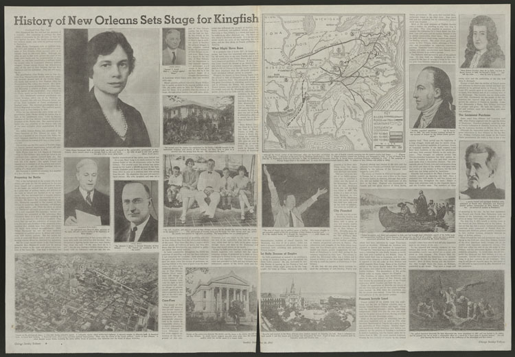
This map shows the eastern half of the United States, focusing on the Mississippi Valley area. In addition to rivers, roads or trails, and mountains, the map indicates the following: the direction of the party led by Governor Spottswood in 1716, the area where pioneers crossed into Kentucky and Tennessee in 1748, the line of French forts in 1752-1754, the area where Washington built Fort Necessity in 1754, the settlement of Tennessee in 1769-1770, the area where Daniel Boone established the Kentucky settlement in 1775, the campaign of George Rogers Clark in the middle west, Aaron Burr's exploration at Blennerhassett Island in 1805, and Jackson with militia in 1815.
1934-09-30
22 x 21.5 cm
Tribune Company
grayscale
- English
- still image
- text
- These materials are either in the public domain, according to U.S. copyright law, or permission has been obtained from rights owners. The digital version and supplementary materials are available for all educational uses worldwide.
- The Janet A. Ginsburg Chicago Tribune Image Collection
- Chicago Sunday Tribune (September 30, 1934), n.p.
- application/pdf
- image/jpeg

- Home
- About
- Full Text Search
- Browse
- Contact Info