
British Magazine Maps
Pirates, Industry and War: 18th Century British Magazine Maps
Monthly topical and current events magazines evolved as a popular publication style in 18th century Great Britain. The most prominent and among the earliest was Gentleman’s Magazine, which began as a digest reprinting the best articles from the slew of dailies and weeklies available in London. Over time it and its many competitors began to offer original content. Maps illustrating articles about military engagements and other current events enhanced sales and became regular features in magazines.
This website reproduces a variety of maps from the MSU Map Library Collection which appeared in British magazines in the 18th century. From them you can see what places and events were of interest to the readership, which was primarily educated males in a growing Empire.
These maps were gifts to the MSU Map Library from Ronald Dietz.
Britain
| Image | Title | Call Number | Description |
|---|---|---|---|
 |
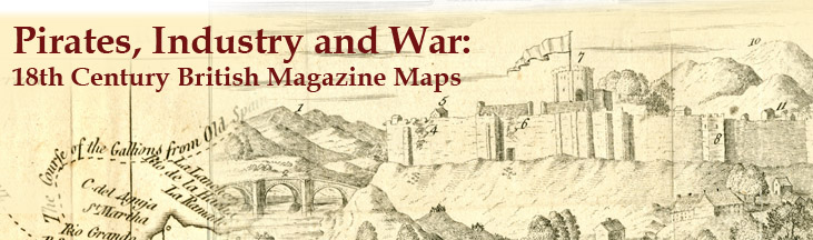
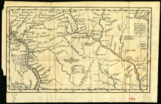
A Map of the Countries adjacent to Carlisle, Shewing the Route of the Rebels with their Principal Fords over ye R.r Eden | 621 c-B-1746 | George Smith. Gentleman's Magazine. |
 |
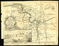
Map of the Black Lead Mines &c in Cumberland | 621 c-A-1751 | Gentleman's Magazine, June 1751. |
 |
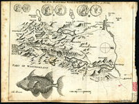
A New Map of England and Wales | 621 c-A-1757 | Gentleman's Magazine, 1757. |
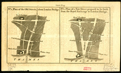 |
No. 1 Plan of the Old Streets about London Bridge; No. 2 Plan of a New Street, Proposed to be Built from the Royal Exchange to London Bridge | 621 d-E-1760 | Gentleman's Magazine. |
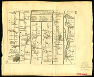 |
A Map of the Roads from London thro Oxford, Worcester, & c. to Aberistwith/The Road from Bristol to Exeter | 621 c-D-1765 | Gentleman's Magazine. |
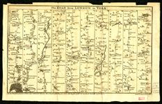 |
The Road from London to York | 621 c-D-1766 | Drawn & Engraved by John Gibson. Gentleman's Magazine, June 1766, opp 249. |
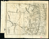 |
A Map of the Surrey Side the Thames from Westminster Bridge to the Borough With a Plan for Laying out the Roads to Blackfyars Bridge | 621 d-A-1766 | Gentleman's Magazine. |
Europe
| Image | Title | Call Number | Description |
|---|---|---|---|
 |
Region along the Rivers Dnipro and Donets, showing Old Limits between the Russian and Turkish Empires | 686 c-B-1739 | Emanuel Bowen. Gentleman's Magazine. |
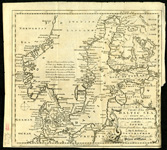 |
A Chart of the Baltic Sea, Gulfs of Finland and Bothnia, with the Sound, drawn from the Best Maps & Charts | 714 A-1748 | Thomas Jeffreys. Gentleman's Magazine, March 1748. |
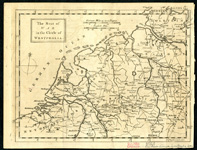 |
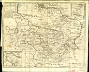
The Seat of War in the Circle of Westphalia | 600.3 B-1757 West | Gentleman's Magazine, 1757 opp 331. |
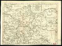 |
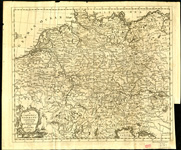
Map of Upper Saxony Comprehending that part of Germany which is the Present Seat of War | 600.3 B-1757 Sax | Gentleman's Magazine. |
 |
A Compleat Map of Germany Comprehending in One View the Different Seats of the Present War 1759 | 640 B-1759 | Gentleman's Magazine EG8. |
 |
Accurate Map of all his Majesty's Dominions in Germany, with the Adjacent Countries | 640 A-1761 | Gentleman's Magazine, January 1761, opp 654. |
 |
Accurate Map of his R.H. the Duke of York's Journey thro Italy in 1763 & 1764 | 655 c-D-1764 | John Gibson. Gentleman's Magazine. |
Americas
| Image | Title | Call Number | Description |
|---|---|---|---|
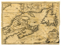 |
A New Chart of the Coast of New England, Nova Scotia, New France or Canada. with the Islands of New Foundld, Cape Breton, St. John's &c | 100 c-A-1746 | Gentleman's Magazine, 1746. |
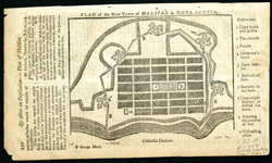 |
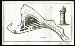
Plan of the New Town of Halifax in Nova Scotia | 132 d-A-1749 | Gentleman's Magazine. |
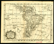 |
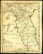
South America upon the Globular Projection | 250 A-1763 | Emanuel Bowen. General Magazine of Arts & Sciences. |
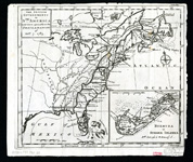 |
The British Governments in Nth America | 100 c-B-1763 | Gentleman's Magazine. |
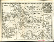 |
An Accurate Map of the West Indies containing the Bahama & Caribbe Islands | 230 A-1763 | Emanuel Bowen. General Magazine of Arts & Sciences. |
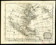 |
North America upon the Globular Projection | 100 A-1763 | Emanuel Bowen. General Magazine of Arts & Sciences, vol. 2 1764. |
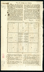 |
Plan for Settling New Colonies | 990 E-1769 | Gentleman's Magazine 1769. |
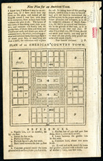 |
Plan of an American Country Town | 990 A-1770 | New Plan for an American Town, Gentleman's Magazine, page 62. |
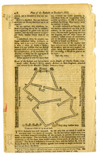 |
Plan of the Redoubt on Bunker Hill | 842 d-B-1775 | Gentleman's Magazine, 1775. |
 |
Old Pt. Royal | 237 d-A-1785 | Gentleman's Magazine, November 1785 opp p. 879. |
Asia
| Images | Title | Call Number | Description |
|---|---|---|---|
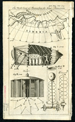 |
490 A-1749 |
Gentleman's Magazine, June 1749, opp 249. |
|
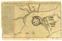 |
A Plan of the Town & Fortress of Gariah Belonging to Angria the Admiral to the Sahou Rajah on the Coast of Mallabar | 430 d-E-1756 | Gentleman's Magazine, 1756. |
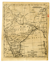 |
The Moguls Empire Divided into its Principal Governments | 430 A-1767 | Gentleman's Magazine, 1767. |
World
| Image | Title | Call Number | Description |
|---|---|---|---|
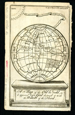 |
A Map of the Old World as it Appeared before God Destroy'd it wth the Waters of the Flood | 050 B-2348BC/1736 | Gentleman's Magazine, December 1736. |
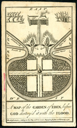 |
A Map of the Garden of Eden before God Destroy'd it with the Flood |
990 B-4122BC/1738 |
Gentleman's Magazine, February 1738. |
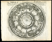 |
Shield of Achilles | 050 M-1749 | Gentleman's Magazine. |
Sources:
- Maps in British Periodicals. By David C. Jolly. Published by David C. Jolly in Brookline, MA in 1990.
- Maps in Eighteenth-Century British Magazines: A Checklist. By Christopher M. Klein. Published as the 3rd Occasional Publication of the Hermon Dunlap Smith Center for the History of Cartography. Published in Chicago by the Newberry Library in 1989.
- Maps of America in Periodicals Before 1800. By David C. Jolly. Published by David C. Jolly in Brookline, MA in 1989
The MSU Map Library extends special thanks to Erika Dietz for her assistance with this online exhibit.