Footpath to Freeway: Michigan Road Maps
- Introduction
- Michigan as a Territory
- State of Michigan - 19th Century
- Automobile Route Guides
- Named Roads
- Standardization of Road Markings
- Rise and Fall of Oil Company Road Maps
- Beginning of a New Era
Footpath to Freeway: The Evolution of Michigan Road Maps
This exhibit traces how roads have been depicted on Michigan maps from the time it was a territory to the present. In addition to maps, it includes photographs, unique short-lived route guides and artifacts. Maps evolved in step with the road system and showed advances such as named roads which were in time replaced with numbered state and federal routes. Publishers include map giants Rand McNally and Gousha who also supplied oil companies with their ubiquitous freely distributed roadmaps.
Part 5: Standardization of Road Markings
Click on thumbnail image to view larger image.
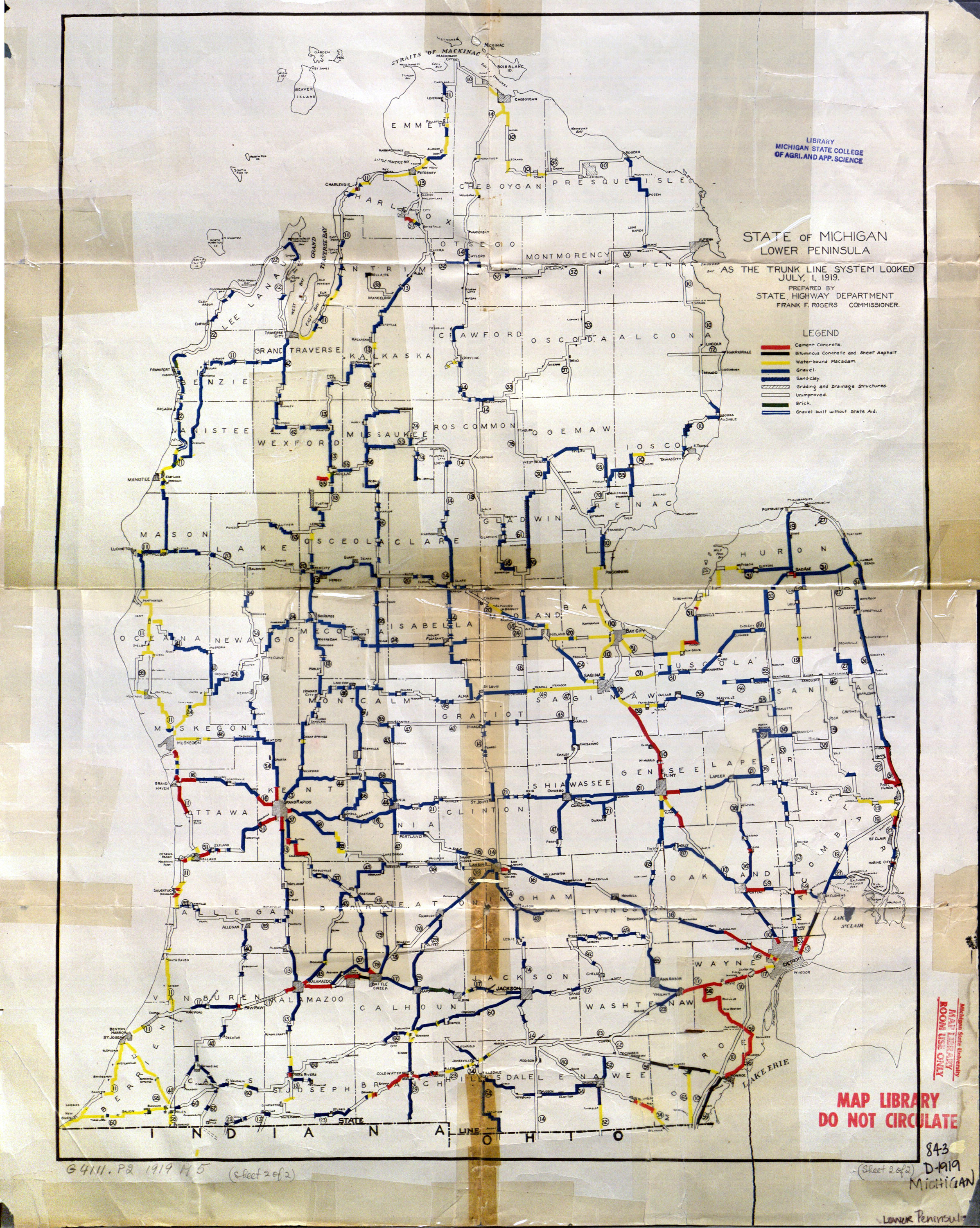
State of Michigan lower peninsula as the trunk line system looked July 1, 1919
The proliferation of "marked" roads, often by competing organizations, generated much confusion among motorists. Sometimes 15 or more route signs would adorn a single pole and following even a marked trail could prove to be difficult to follow.
In 1918, the state of Michigan, following the lead of Wisconsin, began to design and mark its own system of interconnected and numbered "state" highways. This first attempt at simplification and systematization proved to be of great value to the motorist. This 1919 map issued by the Department of Highways is one of the first to denote state route numbers as well as road surface type; relatively few roads at the time were paved.

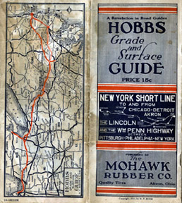
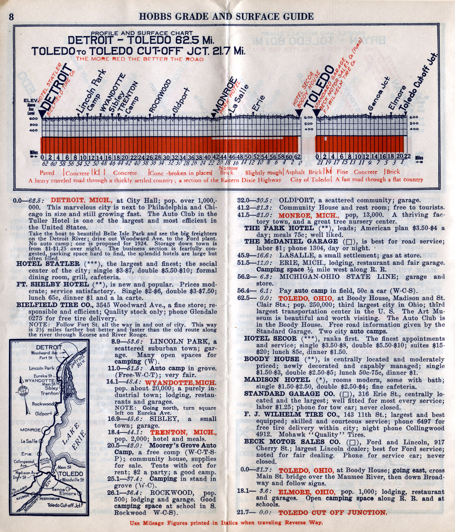
Hobbs Grade and Surface Guide
This unusual Hobbs Grade and Surface Guide, was a short-lived product issued by Mohawk Rubber of Akron, Ohio. It depicts mile-by-mile elevation and road surface conditions along with a cross-section profile of major driving routes such as the Detroit-Toledo route shown.
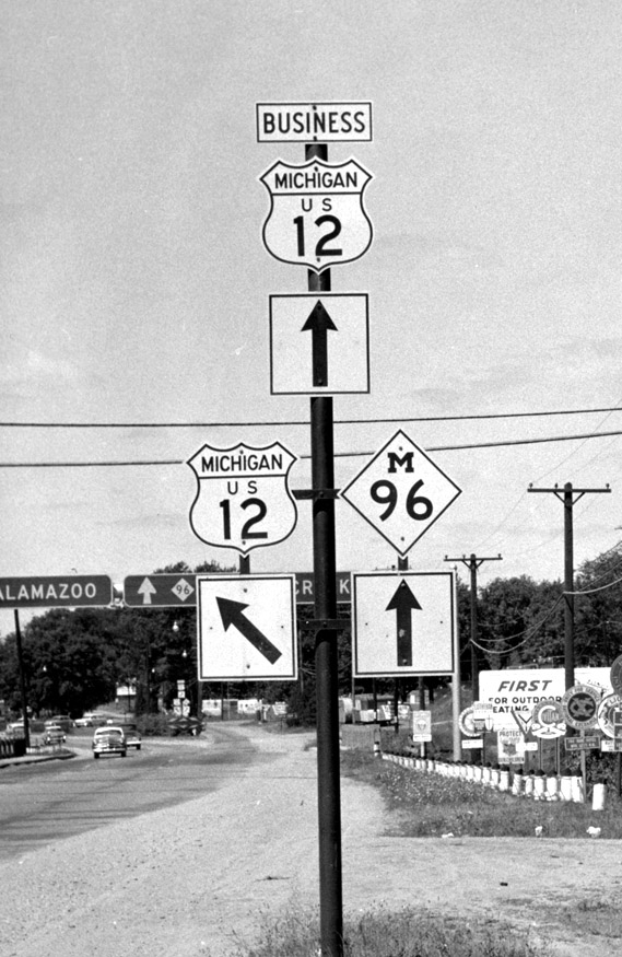
Road sign east of Battle Creek, Michigan
The final step in systematic highway marking occurred in 1926 with the adoption of a federal highway numbering system that was able to address the sign variations that occurred at state borders. In that year, primarily because of the efforts of the American Association of State Highway Officials, a coordinated Federal – State numbering system was approved. Even-numbers were assigned to interstate roads running east/west and odd-numbers were given to those running north/ south. The distinctive, black white shield marker used on the federal, interstate numbered highways was designed by Fred Rogers of Michigan.