
The Evolution of Michigan's Legal Boundaries
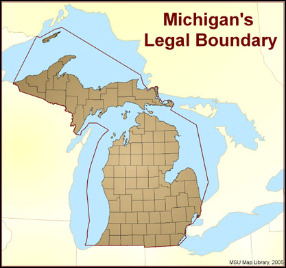 Few published maps show Michigan’s true boundary. Michigan’s legal boundary does not stop at the shoreline of the four Great Lakes that encircle it, but extends into them to include almost 40,000 square miles of water, comprising 40% of Michigan’s area. Most maps of Michigan show only the upper and lower peninsulas plus a few major islands. The U.S. Geological Survey, however, recognizes 420 named islands in the Great Lakes belonging to Michigan. Michigan's legal boundary was established in a 1836 Act prior to attaining statehood on January 26, 1837. Since statehood, eight challenges to the boundary have resulted in adjustments that relinquished territory to Minnesota, Wisconsin, and Ohio, but gained territory from Canada.
Sugar Island/St. George’s Island
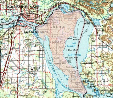 The Webster-Ashburton Treaty, signed August 9, 1842, settled a border dispute with Great Britain in which Michigan gained governance over Sugar Island in the St. Mary's River near Sault Ste. Marie. At the same time, its name was changed from the Canadian name St. George’s Island.
The Minnesota Sliver
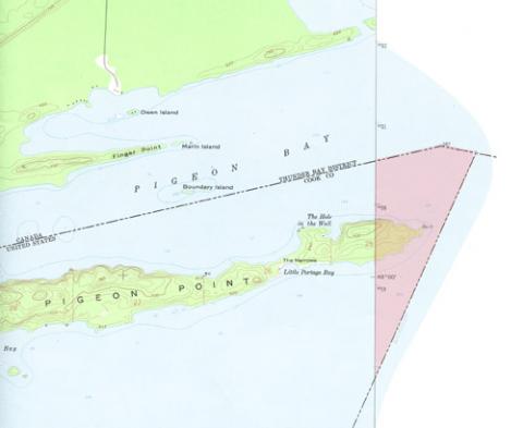 The Webster-Ashburton Treaty also settled the location of a point in Lake Superior that subsequently caused Michigan to relinquish a sliver of Lake Superior to Minnesota.
The Toledo Strip
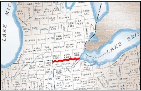 Part 1: The boundary with Ohio was hotly contested in the 1830s as a result of two surveys left a 468 square mile area of dispute on the Michigan-Ohio boundary. At the time of statehood, Michigan accepted the western portion of the Upper Peninsula instead of the "Toledo Strip".
Part 2: By 1914 survey markers had disappeared and the referenced "North Cape" of the Maumee river had eroded. To settle the new dispute peacefully, the line was re-surveyed in 1915 and marked with sturdy granite pillars. Both sides agreed to accept whatever lines were agreed by landowners on both sides of the state line, resulting in a "sawtooth" shaped boundary. The project was described in a 1916 report.
The Wisconsin Wedge
 A Supreme Court decision on November 22, 1926 (Michigan v. Wisconsin 272 US 398) awarded a sliver of land to Wisconsin. The dispute arose because the original 1836 boundary description referenced a situation that did not exist: The referenced Montreal River did not originate from the Lake of the Desert.
Menominee River Islands
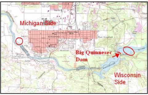 The islands of the Menominee River were divided in half by the US Supreme Court in 1926: Those north of Quinnesec Falls (now the site of Big Quinnesec Dam) were awarded to Michigan, and those south of the falls were awarded to Wisconsin. (Michigan v. Wisconsin 272 US 398)
When Is An Island Not An Island?
 Merryman Island would have gone to Wisconsin by the Menominee River Islands agreement described above. The U.S. Supreme Court created an exception by declaring in the case Michigan v. Wisconsin, decided November 22, 1926, that Merryman Island in Menominee County is "part of the mainland of Michigan" and therefore not subject to the prior decision.
The Green Bay Channel & Islands
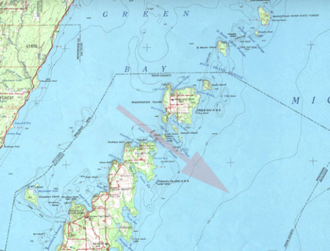 The 1836 boundary description described the line through northwest Lake Michigan as "the most usual ship channel". This description needed clarification as two routes were in use. The Supreme Court decision chose the northernmost ship channel, in which Michigan lost the intervening water area and four islands: Plum, Detroit, Washington, and Rock. The Michigan-Wisconsin boundary was finally settled and described in full on March 16, 1936, in Wisconsin v Michigan 297 US 547.
The Lake Erie Triangle
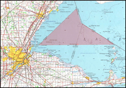 The most recent dispute with Ohio brought into contention about 150 square miles of Lake Erie. Should the "northeast" line be a continuation of the gentle angle created by the Toledo Strip, or should upon reaching Lake Erie, the line turn to a 45˚ angle? On February 22, 1973, the Supreme Court decided in favor of Ohio (Michigan v Ohio, 410 US 420).